| URL | http://<mapservice-url>/<layerOrTableId> |
|---|---|
| Supported Operations | Query Query Related Records Generate Renderer |
| Parent Resource | Map Service |
| Child Resources | Feature Image |
| Required Capability | Map |
Description
Note: Prior to 10, this resource represented only a layer.
From 10 onward, it represents either a layer or a table depending on whether the
layerOrTableId is that of a layer or of a table.
The layer / table resource represents a single layer / table in a map of a map service published by ArcGIS Server. It provides basic information about the layer / table such as its name, type and fields. For layers, it provides additional information about the layer such as its parent and sub-layers, min and max scales, extent, and copyright text.
New in 10.1 SP1
- If ownership-based access control is enabled on features,
ownershipBasedAccessControlForFeaturesproperty of a layer will include anallowOthersToQueryproperty.
New in 10.1
-
Layer resource supports a new parameter -
returnUpdatesthat accepts a boolean value. Pass this parameter to retrieve updatedtimeExtentfor the layer. - Layer now supports a new operation - generateRenderer. Use this to generate a class breaks or unique value renderer.
-
A new property
canModifyLayerwas added. Use this property on the Layer / Table resource to determine if a layer supports modifying its renderer and/or data source. -
Layer resource contains
hasLabelsto indicate if the layer has labels defined on it, andcanScaleSymbolsif the text and symbols on the layer will change as the map scale varies. - Layer resource contains
hasLiveDatathat returns a boolean value. This value is true if the layer's data gets updated frequently. This property is independent ofhasLiveDatathat is available on the map service resource. -
Layer resource contains
maxRecordCountthat represents the maximum number of records that can be returned by query, find, and identify operations. -
Layer resource contains
supportsStatisticsthat indicates if the layer supports statistical functions in query operations andsupportsAdvancedQueriesto indicate if the layer supportsorderByin a query operation. -
Layer resource contains
supportedQueryFormats. This value indicates the supported output formats for a query operation. -
Layer resource contains
hasZandhasMto indicate if the layer geometry contains Z and/or M values respectively. -
Layer resource now returns
role,cardinality,keyField,isComposite,relationshipTableIdandkeyFieldInRelationshipTableproperties forrelationships. - Layer resource now returns two new properties:
effectiveMinScaleandeffectiveMaxScale. Effective minimum and maximum scale are calculated based on theminScaleandmaxScalevalues of the current layer and its ancestors. These represent the effective minimum and maximum scales at which the layer is visible. - Layer resource includes
isDataVersionedif the layer is versioned.
New in 10.0
- The layer / table resource represents a single layer / table in a map of a map service published by ArcGIS Server. It provides basic information about the layer / table such as its name, type and fields. For layers, it provides additional information about the layer such as its parent and sub-layers, min and max scales, extent, and copyright text. From 10 onward, it also provides information regarding the relationship of this layer / table with other layers / tables in the map service. A property to indicate whether the layer / table has attachments or not was also added at 10.
-
Support for time-aware layers / tables was added at 10.
If a layer / table supports quering and exporting maps based on time,
the response will include a
timeInfoproperty which includes information such as the start time field (or the time instance field), the end time field, the track ID field, the layer's time extent and the suggested draw time interval.
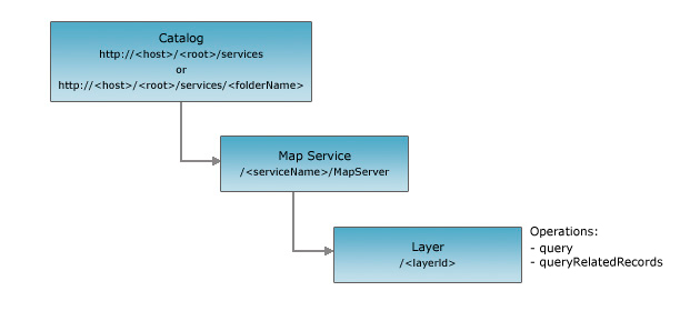
Resource Hierarchy
Parameters
| Parameter | Details |
|---|---|
| f | Description: The
response format. The default response format is html. Values: html | json |
| returnUpdates |
//This option was added at 10.1 Description: If value is true then returns updated time extent. If the layer is not time-aware then returns an empty response. Values: true | false |
Example Usage
Example 1: Get information about layerId 3 in the Census map service on serviecsbeta2:
Example 1: Getting updated time information:
http://servicesbeta2.esri.com/arcgis/rest/services/Wildfire/MapServer/2?returnUpdates=true&f=pjson
JSON Response Syntax
{
"currentVersion": <currentVersion>, //Added at 10.0 SP1
"id" : <layerOrTableId>,
"name" : "<layerOrTableName>",
"type" : "<layerOrTableType>", //for tables, the type will be "Table"
"description" : "<description>",
"definitionExpression" : "<definitionExpression>",

//properties specific to layers only
"geometryType" : "<geometryType>",
"hasZ" : <true|false>, //added in 10.1
"hasM" : <true|false>, //added in 10.1
"copyrightText" : "<copyrightText>",
"parentLayer" : {"id" : <parentLayerId>, "name" : "<parentLayerName>"},
"subLayers" : [
    {"id" : <subLayerId1>, "name" : "<subLayerName1>"},
    {"id" : <subLayerId2>, "name" : "<subLayerName2>"}
],
"minScale" : <minScale>,
"maxScale" : <maxScale>,
"effectiveMinScale" : <effectiveMinScale>,
"effectiveMaxScale" : <effectiveMaxScale>,
"defaultVisibility" : <true | false>,
"extent" :  <envelope>,

//from 10 onward - if the layer / table supports querying and exporting maps based on time
"timeInfo" : {
  "startTimeField" : "<startTimeFieldName>",
  "endTimeField" : "<endTimeFieldName>",
  "trackIdField" : "<trackIdFieldName>",
  "timeExtent" : [<startTime>, <endTime>],
  "timeReference" : {
    "timeZone" : "<timeZone>",
    "respectsDaylightSaving" : <true | false>
  },
  "timeInterval" : <timeInterval>,
  "timeIntervalUnits" : "<timeIntervalUnits>",
  //the default time-related export options for this layer
  "exportOptions" : {
    //If true, use the time extent specified by the time parameter
    "useTime" : < true | false >,
    //If true, draw all the features from the beginning of time for that data
    "timeDataCumulative" : < true | false >,
    //Time offset for this layer so that it can be overlaid on the top of a previous or future time period
    "timeOffset" : <timeOffset1>,
    "timeOffsetUnits" : "<esriTimeUnitsCenturies | esriTimeUnitsDays | esriTimeUnitsDecades |
                             esriTimeUnitsHours | esriTimeUnitsMilliseconds | esriTimeUnitsMinutes |
                             esriTimeUnitsMonths | esriTimeUnitsSeconds | esriTimeUnitsWeeks | esriTimeUnitsYears |
                             esriTimeUnitsUnknown>"
  }
  "hasLiveData" : <true | false>,
},

//from 10.0 onward - for feature layers only
"drawingInfo" : {
  "renderer" : <renderer>,
  "transparency" : <transparency>,
  "labelingInfo" : <labelingInfo>
},

//from 10 onward - indicates whether the layer / table has attachments or not
"hasAttachments" : <true | false>,

//from 10 onward - indicates whether the layer / table has htmlPopups
"htmlPopupType" : "<esriServerHTMLPopupTypeNone | esriServerHTMLPopupTypeAsURL | esriServerHTMLPopupTypeAsHTMLText>",

//layer / table field information
"displayField" : "<displayFieldName>",
//the typeIdField is new at 10.0
"typeIdField" : "<typeIFieldName>",
//from 10.0 fields of type (String, Date, GlobalID, GUID and XML) have an additional length property
//from 10.0 onward the field domains are also included
"fields" : [
    {"name" : "<fieldName1>", "type" : "<fieldType1>", "alias" : "<fieldAlias1>", "length" : "<length1>", "domain" : <domain1>},
    {"name" : "<fieldName2>", "type" : "<fieldType2>", "alias" : "<fieldAlias2>", "length" : "<length2>", "domain" : <domain2>}
],
//new at 10.0 - if the layer has sub-types, they'll be included
"types" : [
  {
    "id" : <typeId1>,
    "name" : "<typeName1>",
    "domains" : {
      "<domainField11>" : <domain11>,
      "<domainField12>" : <domain12>
    }
  },
  {
    "id" : <typeId2>,
    "name" : "<typeName2>",
    "domains" : {
      "<domainField11>" : <domain21>,
      "<domainField12>" : <domain22>
    }
  }
],

//new at 10 - if the layer / table participates in relationships with other layers / tables
"relationships" : [
  {
    "id" : <relationshipId1>,
    "name" : "<relationshipName1>",
    "relatedTableId" : <relatedTableId1>,
    "role" : "<esriRelRoleOrigin>|<esriRelRoleDestination>";,//Added at 10.1
    "cardinality" : "<esriRelCardinalityOneToOne>|<esriRelCardinalityOneToMany>|<esriRelCardinalityManyToMany>";,//Added at 10.1
    "keyField" : "<keyFieldName2>",//Added at 10.1
    "isComposite" : <true>|<false>,//Added at 10.1
    "relationshipTableId": <attributedRelationshipClassTableId>,  //Added in 10.1. Returned only for attributed relationships
    "keyFieldInRelationshipTable": "<key field in AttributedRelationshipClass table that matches keyField>" //Added in 10.1. Returned only for attributed relationships

  },
  {
    "id" : <relationshipId2>,
    "name" : "<relationshipName2>",
    "relatedTableId" : <relatedTableId2>,
    "role" : "<esriRelRoleOrigin>|<esriRelRoleDestination>";,//Added at 10.1
    "cardinality" : "<esriRelCardinalityOneToOne>|<esriRelCardinalityOneToMany>|<esriRelCardinalityManyToMany>";,//Added at 10.1
    "keyField" : "<keyFieldName2>",//Added at 10.1
    "isComposite" : <true>|<false>,//Added at 10.1
    "relationshipTableId": <attributedRelationshipClassTableId>,  //Added in 10.1. Returned only for attributed relationships
    "keyFieldInRelationshipTable": "<key field in AttributedRelationshipClass table that matches keyField>" //Added in 10.1. Returned only for attributed relationships
  }
],
//new at 10.1
"maxRecordCount": <recordCount>,
//new at 10.1 - if the layer / table supports modifying its renderer, data source, or join information.
"canModifyLayer": <true | false>,
//new at 10.1 - if the layer / table supports statistical functions in query operation.
"supportsStatistics": <true | false>,
//new at 10.1 - if the layer / table supports orderBy parameter in query operation.
"supportsAdvancedQueries": <true | false>,
//new at 10.1 - if the layer has labels defined on it.
"hasLabels": <true | false>,
//new at 10.1 - if the layer renders its symbols based on scale.
"canScaleSymbols": <true | false>,
//comma separated list of supported capabilities - e.g. "Map,Query,Data"
"capabilities": "<capabilities>",
//comma separated list of supported query output formats - e.g. "JSON, AMF"
"supportedQueryFormats": "<supported query output formats>",
//true if the layer is versioned.
"isDataVersioned": <true | false>,
//new at 10.1 SP1.
"ownershipBasedAccessControlForFeatures":
{
 "allowOthersToQuery": <true | false>
}
}
JSON Response Example
{
 "currentVersion": 10.1,
 "id": 3,
 "name": "states",
 "type": "Feature Layer",
 "description": "This service presents various population statistics from Census 2000, including total population, population density, racial counts, and more. The map service presents statistics at the state, county, block group, and block point levels.\n",
 "definitionExpression": "",
 "geometryType": "esriGeometryPolygon",
 "copyrightText": "US Bureau of the Census: http://www.census.gov",
 "parentLayer": null,
 "subLayers": [],
 "minScale": 0,
 "maxScale": 0,
 "drawingInfo": {
  "renderer": {
   "type": "simple",
   "symbol": {
    "type": "esriSFS",
    "style": "esriSFSSolid",
    "color": [
     0,
     0,
     0,
     0
    ],
    "outline": {
     "type": "esriSLS",
     "style": "esriSLSSolid",
     "color": [
      0,
      0,
      0,
      255
     ],
     "width": 2
    }
   },
   "label": "",
   "description": ""
  },
  "transparency": 0,
  "labelingInfo": null
 },
 "defaultVisibility": true,
 "extent": {
  "xmin": -178.21759836267427,
  "ymin": 18.9217863446641,
  "xmax": -66.96927103622932,
  "ymax": 71.40623536706858,
  "spatialReference": {
   "wkid": 4269,
   "latestWkid": 4269
  }
 },
 "hasAttachments": false,
 "htmlPopupType": null,
 "displayField": "STATE_NAME",
 "typeIdField": null,
 "fields": [
  {
   "name": "OBJECTID",
   "type": "esriFieldTypeOID",
   "alias": "OBJECTID",
   "domain": null
  },
  {
   "name": "STATE_NAME",
   "type": "esriFieldTypeString",
   "alias": "STATE_NAME",
   "length": 25,
   "domain": null
  },
  {
   "name": "STATE_FIPS",
   "type": "esriFieldTypeString",
   "alias": "STATE_FIPS",
   "length": 2,
   "domain": null
  },
  {
   "name": "SUB_REGION",
   "type": "esriFieldTypeString",
   "alias": "SUB_REGION",
   "length": 20,
   "domain": null
  },
  {
   "name": "STATE_ABBR",
   "type": "esriFieldTypeString",
   "alias": "STATE_ABBR",
   "length": 2,
   "domain": null
  },
  {
   "name": "POP2000",
   "type": "esriFieldTypeInteger",
   "alias": "POP2000",
   "domain": null
  },
  {
   "name": "POP2007",
   "type": "esriFieldTypeInteger",
   "alias": "POP2007",
   "domain": null
  },
  {
   "name": "POP00_SQMI",
   "type": "esriFieldTypeDouble",
   "alias": "POP00_SQMI",
   "domain": null
  },
  {
   "name": "POP07_SQMI",
   "type": "esriFieldTypeDouble",
   "alias": "POP07_SQMI",
   "domain": null
  },
  {
   "name": "WHITE",
   "type": "esriFieldTypeInteger",
   "alias": "WHITE",
   "domain": null
  },
  {
   "name": "BLACK",
   "type": "esriFieldTypeInteger",
   "alias": "BLACK",
   "domain": null
  },
  {
   "name": "AMERI_ES",
   "type": "esriFieldTypeInteger",
   "alias": "AMERI_ES",
   "domain": null
  },
  {
   "name": "ASIAN",
   "type": "esriFieldTypeInteger",
   "alias": "ASIAN",
   "domain": null
  },
  {
   "name": "HAWN_PI",
   "type": "esriFieldTypeInteger",
   "alias": "HAWN_PI",
   "domain": null
  },
  {
   "name": "OTHER",
   "type": "esriFieldTypeInteger",
   "alias": "OTHER",
   "domain": null
  },
  {
   "name": "MULT_RACE",
   "type": "esriFieldTypeInteger",
   "alias": "MULT_RACE",
   "domain": null
  },
  {
   "name": "HISPANIC",
   "type": "esriFieldTypeInteger",
   "alias": "HISPANIC",
   "domain": null
  },
  {
   "name": "MALES",
   "type": "esriFieldTypeInteger",
   "alias": "MALES",
   "domain": null
  },
  {
   "name": "FEMALES",
   "type": "esriFieldTypeInteger",
   "alias": "FEMALES",
   "domain": null
  },
  {
   "name": "AGE_UNDER5",
   "type": "esriFieldTypeInteger",
   "alias": "AGE_UNDER5",
   "domain": null
  },
  {
   "name": "AGE_5_17",
   "type": "esriFieldTypeInteger",
   "alias": "AGE_5_17",
   "domain": null
  },
  {
   "name": "AGE_18_21",
   "type": "esriFieldTypeInteger",
   "alias": "AGE_18_21",
   "domain": null
  },
  {
   "name": "AGE_22_29",
   "type": "esriFieldTypeInteger",
   "alias": "AGE_22_29",
   "domain": null
  },
  {
   "name": "AGE_30_39",
   "type": "esriFieldTypeInteger",
   "alias": "AGE_30_39",
   "domain": null
  },
  {
   "name": "AGE_40_49",
   "type": "esriFieldTypeInteger",
   "alias": "AGE_40_49",
   "domain": null
  },
  {
   "name": "AGE_50_64",
   "type": "esriFieldTypeInteger",
   "alias": "AGE_50_64",
   "domain": null
  },
  {
   "name": "AGE_65_UP",
   "type": "esriFieldTypeInteger",
   "alias": "AGE_65_UP",
   "domain": null
  },
  {
   "name": "MED_AGE",
   "type": "esriFieldTypeDouble",
   "alias": "MED_AGE",
   "domain": null
  },
  {
   "name": "MED_AGE_M",
   "type": "esriFieldTypeDouble",
   "alias": "MED_AGE_M",
   "domain": null
  },
  {
   "name": "MED_AGE_F",
   "type": "esriFieldTypeDouble",
   "alias": "MED_AGE_F",
   "domain": null
  },
  {
   "name": "HOUSEHOLDS",
   "type": "esriFieldTypeInteger",
   "alias": "HOUSEHOLDS",
   "domain": null
  },
  {
   "name": "AVE_HH_SZ",
   "type": "esriFieldTypeDouble",
   "alias": "AVE_HH_SZ",
   "domain": null
  },
  {
   "name": "HSEHLD_1_M",
   "type": "esriFieldTypeInteger",
   "alias": "HSEHLD_1_M",
   "domain": null
  },
  {
   "name": "HSEHLD_1_F",
   "type": "esriFieldTypeInteger",
   "alias": "HSEHLD_1_F",
   "domain": null
  },
  {
   "name": "MARHH_CHD",
   "type": "esriFieldTypeInteger",
   "alias": "MARHH_CHD",
   "domain": null
  },
  {
   "name": "MARHH_NO_C",
   "type": "esriFieldTypeInteger",
   "alias": "MARHH_NO_C",
   "domain": null
  },
  {
   "name": "MHH_CHILD",
   "type": "esriFieldTypeInteger",
   "alias": "MHH_CHILD",
   "domain": null
  },
  {
   "name": "FHH_CHILD",
   "type": "esriFieldTypeInteger",
   "alias": "FHH_CHILD",
   "domain": null
  },
  {
   "name": "FAMILIES",
   "type": "esriFieldTypeInteger",
   "alias": "FAMILIES",
   "domain": null
  },
  {
   "name": "AVE_FAM_SZ",
   "type": "esriFieldTypeDouble",
   "alias": "AVE_FAM_SZ",
   "domain": null
  },
  {
   "name": "HSE_UNITS",
   "type": "esriFieldTypeInteger",
   "alias": "HSE_UNITS",
   "domain": null
  },
  {
   "name": "VACANT",
   "type": "esriFieldTypeInteger",
   "alias": "VACANT",
   "domain": null
  },
  {
   "name": "OWNER_OCC",
   "type": "esriFieldTypeInteger",
   "alias": "OWNER_OCC",
   "domain": null
  },
  {
   "name": "RENTER_OCC",
   "type": "esriFieldTypeInteger",
   "alias": "RENTER_OCC",
   "domain": null
  },
  {
   "name": "NO_FARMS97",
   "type": "esriFieldTypeDouble",
   "alias": "NO_FARMS97",
   "domain": null
  },
  {
   "name": "AVG_SIZE97",
   "type": "esriFieldTypeDouble",
   "alias": "AVG_SIZE97",
   "domain": null
  },
  {
   "name": "CROP_ACR97",
   "type": "esriFieldTypeDouble",
   "alias": "CROP_ACR97",
   "domain": null
  },
  {
   "name": "AVG_SALE97",
   "type": "esriFieldTypeDouble",
   "alias": "AVG_SALE97",
   "domain": null
  },
  {
   "name": "SQMI",
   "type": "esriFieldTypeInteger",
   "alias": "SQMI",
   "domain": null
  },
  {
   "name": "Shape",
   "type": "esriFieldTypeGeometry",
   "alias": "Shape",
   "domain": null
  },
  {
   "name": "Shape_Length",
   "type": "esriFieldTypeDouble",
   "alias": "Shape_Length",
   "domain": null
  },
  {
   "name": "Shape_Area",
   "type": "esriFieldTypeDouble",
   "alias": "Shape_Area",
   "domain": null
  }
 ],
 "relationships": [],
 "canModifyLayer": true,
 "canScaleSymbols": false,
 "hasLabels": false,
 "capabilities": "Map,Query,Data",
 "maxRecordCount": 1000,
 "supportsStatistics": true,
 "supportsAdvancedQueries": true,
 "supportedQueryFormats": "JSON, AMF",
 "ownershipBasedAccessControlForFeatures":
 {
  "allowOthersToQuery": true;
 }
}
JSON Response Syntax (when returnUpdates is true)
{
 "id": <layer id>,
 "timeExtent": [
  <start time>,
  <end time>
 ]
}