| URL | http://<service-info-url>/iteminfo |
|---|---|
| Parent Resource | Info |
Description
The item information resource returns the item information card for the service which includes information such as description, summary, tags etc authored with the service.
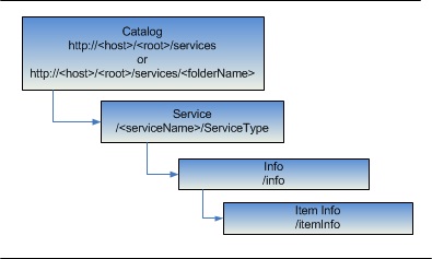
Resource Hierarchy
Parameters
| Parameter | Details |
|---|---|
| f | Description: The
response format. The default response format is html. Values: html | json |
Example Usage
Example 1: Return item information for a MapService in JSON format:
http://servicesbeta2.esri.com/arcgis/rest/services/SF311/MapServer/info/iteminfo?f=pjsonJSON Response Syntax
{
 "culture": "<culture>",
 "name": "<servicename>",
 "guid": "<guid>",
 "catalogpath": "<catalogpath>",
 "snippet": "<snippet>",
 "description": "<description>",
 "Summary": "<service summary>",
 "title": "<title>",
 "tags": [
  "<tag1>",
  "<tag2>",
  "<tag3>"
 ],
 "type": "<service type>",
 "typekeywords": [
  "<typekeyword1>",
  "<typekeyword2>",
  "<typekeyword3>",
  "<typekeyword4>"
 ],
 "thumbnail": "<relative thumbnail url>",
 "url": "",
 "extent": {
  "xmin": "<xmin>",
  "ymin": ">ymin>",
  "xmax": ">xmax>",
  "ymax": ">ymax>"
 },
 "spatialreference": "<spatialreference>",
 "accessinformation": "<service access information>",
 "licenseinfo": "<service licence information >"
}
JSON Response Example
{
 "culture": "en-US",
 "name": "sanfrancisco_museums",
 "guid": "2D4D1E57-3613-4288-9221-90C97FB2803B",
 "catalogpath": "",
 "snippet": "Sample Map containg San Francisco Museum data",
 "description": "Sample Map containing point of interests in San Francisco (museums)",
 "Summary": "Sample Map containg San Francisco Museum data",
 "title": "Clustering",
 "tags": [
  "San Francisco",
  "Museums"
 ],
 "type": "Map Service",
 "typekeywords": [
  "Data",
  "Service",
  "Map Service",
  "ArcGIS Server"
 ],
 "thumbnail": "thumbnail/thumbnail.png",
 "url": "http://server/arcgis/services/sanfrancisco_museums/",
 "extent": {
  "xmin": "-122.515048",
  "ymin": "37.632528",
  "xmax": "-122.293731",
  "ymax": "37.863433"
 },
 "spatialreference": "GCS_WGS_1984",
 "accessinformation": "esri",
 "licenseinfo": "This is a test service."
}