| URL | http://<job-url>/results/<param-name> |
|---|---|
| Parent Resource | Job |
Description
The GP result resource represents a result parameter for a GP job. It provides information about the result parameter such as its name, data type and value. The value is the most important piece of information provided by this resource. Based on the data type of the parameter, the values provide different types of information. Given this fact, the value will have different structures based on the data type as defined below.
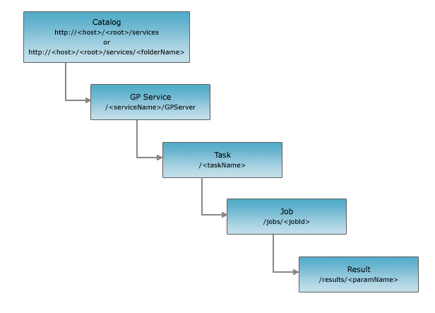
Resource Hierarchy
Parameters
| Parameter | Details |
|---|---|
| f | Description: The
response format. The default response format is html. Support for f=amf was added at 10.Values: html | json | image | kmz | amf |
| outSR |
Description: The spatial reference of the output geometries.
The spatial reference can be specified as either a well-known ID or as a spatial reference json object. This parameter is applicable for result parameters that contain geometries. This parameter can be used to return the geometries in a spatial reference that is different from the spatial reference in which the outputs were initially created. |
| returnType | Description: If
the GP service is associated with a result map service, the default
output for GPRasterDataLayer and GPFeatureSetLayer parameters is a map image. However,
you can explicitly request the raw raster data by using
returnType and setting
its value to data.Values: data |
| returnZ |
//This option was added at 10.1 Description: This applies to result returning GPFeatureRecordSetLayer. If true, Z values will be included in the results if the features have Z values.
Otherwise Z values are not returned. The default is false.
|
| returnM |
//This option was added at 10.1 Description: This applies to result returning GPFeatureRecordSetLayer. If true, M values will be included in the results if the features have M values.
Otherwise M values are not returned. The default is false.
|
Example Usage
Example 1: For a Mailing List task job as described in the Job Details doc's Examples section, you can get access to its Report_html result parameter with the following URL:
http://sampleserver2.arcgisonline.com/ArcGIS/rest/services/Portland/ESRI_CadastralData_Portland/GPServer/MailingList/jobs/jdb4cce48c464424e913c15c4f419b32a/results/Report_html
Note that jdb4cce48c464424e913c15c4f419b32a is an example Job ID and the Job ID of your job might vary.
JSON Response Syntax
{
"paramName" : "<paramName>",
"dataType" : "<dataType>",
"value" : <valueLiteralOrObject>
}
JSON Response Example
{
"paramName" : "Output_String",
"dataType" : "GPString",
"value" : "TestString"
}
Parameter Values
The value
field in the JSON response above can vary based on the data type of the
parameter. For certain data types such as GPFeatureRecordSetLayer and
GPRasterDataLayer, it can vary further based on whether the GP service
is associated with a result map service or not.
GPBoolean, GPDouble, GPLong and GPString
These simple data types have parameter values that are their literal values.
JSON Response Syntax
{
"paramName" : "<paramName>",
"dataType" : "<GPBoolean | GPDouble | GPLong | GPString>",
"value" : <valueLiteral>
}
JSON Response Example
{
"paramName" : "Output_Double",
"dataType" : "GPDouble",
"value" : 1234.56
}
GPDate
The value for GPDate data type is a number that represents the number of milliseconds since epoch (January 1, 1970) in UTC.
JSON Response Syntax
{
 "paramName": "<paramName>",
 "dataType": "GPDate",
 "value": <millisecondsSinceEpoch>
}
JSON Response Example
{
 "paramName": "Output_Date",
 "dataType": "GPDate",
 "value": 1199145600000 // 1 Jan 2008 00:00:00 GMT
}
Note that the string based representation of dates has been deprecated at 10 and is no longer supported.
GPLinearUnit
The parameter value for GPLinearUnit is a JSON structure with the following fields.
distance: a double value.units: a string whose values can be"esriMeters","esriMiles", etc.
JSON Response Syntax
{
"paramName" : "<paramName>",
"dataType" : "GPLinearUnit",
"value" : { "distance" : <distance>, "units" : "<units>" }
}
JSON Response Example
{
"paramName" : "Output_Linear_Unit",
"dataType" : "GPLinearUnit",
"value" : { "distance" : 1234.56, "units" : "esriMiles" }
}
GPDataFile
The
parameter value for GPDataFile is a JSON structure
with a url
field. The value of the url field is
a URL to the location of the data file.
JSON Response Syntax
{
"paramName" : "<paramName>",
"dataType" : "GPDataFile",
"value" : { "url" : "<url>" }
}
JSON Response Example
{
"paramName" : "Output_File",
"dataType" : "GPDataFile",
"value" :
 {
 "url" : "http://flame7/arcgisjobs/ByValTools_GPServer/J1E7A1738AC054CDCBFC4A413DD9033CE/scratch/output.txt"
 }
}
GPRasterData
The parameter value for GPRasterData is a JSON structure with the following fields.
url: a URL to the location of the raster data file.format: a string representing the format of the raster.
JSON Response Syntax
{
"paramName" : "<paramName>",
"dataType" : "GPRasterData",
"value" : { "url" : "<url>", "format" : "<format>" }
}
JSON Response Example
{
"paramName" : "Output_Raster",
"dataType" : "GPRasterData",
"value" :
 {
 "url" : "http://flame7/arcgisjobs/ByValTools_GPServer/JD613584CA6AC462AB8229A9A27B3DA79/scratch/slpgrd.tif",
 "format" : "tif"
 }
}
GPRecordSet
The
parameter value for GPRecordSet is a JSON
structure with the field features.
The features
field is an array of features.
Each feature in turn contains an attributes
field. attributes are key-value pairs
where
the key is a field name in the list of fields of the record set
and the value is the value of the corresponding field.
Note: At 9.3 SP1 an exceededTransferLimit property was added to the JSON response.
This property will be true only if the number of records exceeds the maximum number configured by the server administrator.
Otherwise, it will be false.
JSON Response Syntax
{
"paramName" : "<paramName>",
"dataType" : "GPRecordSet",
"value" :
 {
"fields":[//Added at 10.1
{"name":"<field1>","type":"<field1Type>","alias":"<field1Alias>"},
{"name":"<field2>","type":"<field2Type>","alias":"<field2Alias>"}
],
 "features" : [
 {
 "attributes" :
 {
 "<field1>" : <value11>,
 "<field2>" : <value12>
  }
  },
 {
 "attributes" :
 {
 "<field1>" : <value21>,
 "<field2>" : <value22>
  }
 }
 ],
"exceededTransferLimit" : false | true
 }
}
JSON Response Example
{
"paramName" : "Output_Record_Set",
"dataType" : "GPRecordSet",
"value" :
 {
"fields": [
{"name": "OBJECTID","type": "esriFieldTypeOID","alias": "OBJECTID"},
{"name": "TextField","type":"esriFieldTypeString","alias": "TextField"},
{"name": "IntField","type":"esriFieldTypeInteger","alias": "IntegerField"},
{"name": "DoubleField","type": "esriFieldTypeDouble","alias": "DoubleField"},
{"name": "DateField","type": "esriFieldTypeDate","alias": "DateField"}
],
 "features" : [
 {
 "attributes" :
 {
 "TextField" : "a",
 "IntField" : 1234,
 "DoubleField" : 1234.56,
 "DateField" : 229564800000
  }
  },
 {
 "attributes" :
 {
 "TextField" : "b",
 "IntField" : 5678,
 "DoubleField" : 5678.91,
 "DateField" : 239564800000
  }
  }
 ],
"exceededTransferLimit" : false
 }
}
Map Images as Results
Map images can be a result of a GP job. If a GP service is associated with a result map service, the results of GPFeatureRecordSetLayer and GPRasterDataLayer data types can be drawn by the result map service and hence can be provided to the client as a map image.
From 10.1 onwards if a GP service is associated with a
result map service, the results of GPFeatureRecordSetLayer and
GPRasterDataLayer data types can be accessed directly using the associated map service resource using the URL format:
http://<catalog-url>/<resultMapServiceName>/MapServer/jobs/<jobid>This is the recommended option for consuming results from a GP Service that has an associated map service. All resources and operations supported in a Map Service (except the dynamic layers) will be supported via this result Map Service resource.
The drawing of the results using the result map service that was supported in prior versions as described in the section below has been deprecated at 10.1.
In such cases where the result is a map image, the value
field for the GP parameter is a JSON structure with a mapImage
field. The structure of the mapImage
field is a JSON object whose structure is same as that of the JSON
response of the export map operation.
Further, most of the query parameters available for the export map
operation are available for GP map image results as well. The
only exceptions are the layers and
the transparent parameters.
The layers
parameter is not available for GP map image results because it exports
the map only for the layer corresponding to the GP parameter.
The transparent parameter is available,
however, the default value is true
for GP map image results whereas the default value is false
for the export map operation.
JSON Response Syntax
{
"paramName" : "<paramName>",
"dataType" : "<GPRasterDataLayer | GPFeatureRecordSetLayer>",
"value" :
 {
 "mapImage" :
 {
 "href" : "<href>",
 "width" : <width>,
 "height" : <height>,
 "extent" : {<envelope>},
 "scale" : <scale>
  }
 }
}
JSON Response Example
{
"paramName" : "Output_Raster_Layer",
"dataType" : "GPRasterDataLayer",
"value" :
 {
 "mapImage" :
 {
 "href" : "http://flame7/arcgisoutput/_ags_map40a7f57f31474933a94b5c672b7205f0.png",
 "width" : 400,
 "height" : 400,
 "extent" : {
 "xmin" : -109.55, "ymin" : 25.76, "xmax" : -86.39, "ymax" : 49.94,
 "spatialReference" : {"wkid" : 4326}
 },
 "scale" : 2.53E7
  }
 }
}
GPRasterDataLayer
If
the GP service is associated with a result map service, the default
output for GPRasterDataLayer parameters is a map
image. However, you can explicitly request the raw
raster data by using the returnType
parameter in the URL and setting its value to data.
If the GP service is not associated with
a result map service, or if the returnType
parameter is set to the value data,
the
parameter value for GPRasterDataLayer is a JSON structure with the
following fields.
url: a URL to the location of the raw raster data.format: a string representing the format of the raster.
JSON Response Syntax
{
"paramName" : "<paramName>",
"dataType" : "GPRasterDataLayer",
"value" : { "url" : "<url>", "format" : "<format>" }
}
JSON Response Example
{
"paramName" : "Output_Raster_Layer",
"dataType" : "GPRasterDataLayer",
"value" :
 {
 "url" : "http://flame7/arcgisjobs/ByRefTools_GPServer/J3D1737BA4584441FACBD5563AD1A47D5/scratch/outrast.tif",
 "format" : "tif"
 }
}
GPFeatureRecordSetLayer
If
the GP service is associated with a result map service, the default
output for GPFeatureRecordSetLayer parameters is a map image. However,
you can explicitly request the feature data by
using the returnType parameter in the URL and
setting its value to data.
If the GP service is not associated with
a result map service or if the returnType
parameter is set to the value data,
the parameter value for GPFeatureRecordSetLayer is a
JSON
structure with the following properties:
features: an array of features. Each feature is defined with properties:geometry: points, lines or polygons. The structure for the geometries is same as the structure of the JSON geometry objects returned by the ArcGIS REST API.attributes: key-value pairs where the key is a field name in the list of fields of the record set and the value is the value of the corresponding field.
spatialReference: the well known ID of a spatial reference.geometryType: the geometry type of theGPFeatureRecordsSetLayer.hasZ=trueif theGPFeatureRecordSetLayerincludes Z values.hasM=trueif theGPFeatureRecordSetLayerincludes M values.fieldscontainingname,aliasandfieldTypeproperties for the fields returned in the response.
JSON Response Syntax
{
"paramName" : "<paramName>",
"dataType" : "GPFeatureRecordSetLayer",
"value" :
 {
 "geometryType" : "<geometryType>",
 "hasZ" : <true|false>,//Added at 10.1
 "hasM" : <true|false>,//Added at 10.1
 "spatialReference" : {<spatialReference>},
"fields":[//Added at 10.1
{"name":"<field1>","type":"<field1Type>","alias":"<field1Alias>"},
{"name":"<field2>","type":"<field2Type>","alias":"<field2Alias>"}
],
 "features" : [
 {
 "geometry" : {<geometry1>},
 "attributes" :
 {
 "<field1>" : <value11>,
 "<field2>" : <value12>
  }
  },
 {
 "geometry" : {<geometry2>},
 "attributes" :
 {
 "<field1>" : <value21>,
 "<field2>" : <value22>
  }
  }
 ]
 }
}
JSON Response Example
{
"paramName" : "Output_Features",
"dataType" : "GPFeatureRecordSetLayer",
"value" :
 {
 "geometryType" : "esriGeometryPoint",
 "hasZ" : true,
 "spatialReference" : {"wkid" : 4326},
"fields": [
{"name": "OBJECTID","type": "esriFieldTypeOID","alias": "OBJECTID"},
{"name": "TextField","type":"esriFieldTypeString","alias": "TextField"},
{"name": "IntField","type":"esriFieldTypeInteger","alias": "IntegerField"},
{"name": "DoubleField","type": "esriFieldTypeDouble","alias": "DoubleField"},
{"name": "DateField","type": "esriFieldTypeDate","alias": "DateField"}
],
 "features" : [
 {
 "geometry" : {"x" : -104.36, "y" : 34.657, "z" : 10.0},
 "attributes" :
 {
 "OBJECTID" : 1,
 "TextField" : "a",
 "IntField" : 1234,
 "DoubleField" : 1234.56,
 "DateField" : 229564800000
  }
 },
 {
 "geometry" : {"x" : -114.749, "y" : 31.439, "z" : 11.0},
  "attributes" :
 {
 "OBJECTID" : 2,
 "TextField" : "b",
 "IntField" : 5678,
 "DoubleField" : 5678.91,
 "DateField" : 239564800000
  }
 }
 ]
 }
}
GPMultiValue
Note that support for the GPMultiValue parameter type was added at 10 and only GPMultiValue:GPString datatype is supported at 10.0
From 10.1 onwards all GP data types will be supported in a GPMultiValue.
The fully-qualified data type for a GPMultiValue parameter is GPMultiValue:<memberDataType>,
where memberDataType is one of the data types defined above. For ex.
GPMultiValue:GPString, GPMultiValue:GPLong, etc.
The parameter value for GPMultiValue data types is a JSON array.
Each element in this array is of the data type as defined by the memberDataType suffix
of the fully-qualified GPMultiValue data type name.
GPMultiValue:GPString data type:
{
 "paramName": "Output_Layers",
 "dataType": "GPMultiValue:GPString",
 "value": ["Parcels", "Street Lights"]
}
Example 2:
GPMultiValue:GPLinearUnit data type:
{
 "paramName": "Output_Distances",
 "dataType": "GPMultiValue:GPLinearUnit",
 "value": [
  { "distance" : 345.67, "units" : "esriMiles" },
  { "distance" : 36, "units" : "esriMiles" }
 ]
}